同底图四联 · 城市空间专题图
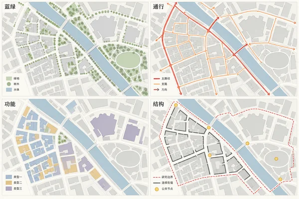
同一场地的蓝绿、通行、功能和结构四联图;可上传底图与已有分类信息。默认案例为原创虚构街区。
Prompt
Create one landscape 3:2 urban thematic board on warm ivory paper, four equal maps in a 2x2 grid with fine white gutters. Use only the short Chinese headings 蓝绿, 通行, 功能, 结构. All four maps share exactly the same orthographic top-down geometry, extent, orientation, building footprints, streets, river and bridges. Flat pale-grey buildings and white streets, crisp fine outlines, no perspective, shadows or satellite texture. In 蓝绿 emphasize only sage parks and tree canopies and grey-blue water. In 通行 show a brick-red primary path, thin orange secondary paths and a few directional arrows. In 功能 assign mist blue, ochre and muted violet to three consistent building categories; do not invent real building uses. In 结构 show a thin red dashed study boundary, dark-grey continuous street edges and warm-yellow public nodes. Keep layers distinct rather than copying arrows across panels. Use small categorical swatches and short labels only, no numeric data, map scale, coordinates, real place names or watermark. If a reference is supplied preserve its identifiable geometry and only map supplied functional and network information; unknown areas stay grey. Otherwise invent a district with a narrow river running upper left to lower right, two short bridges, three compact courtyard blocks west of it, two larger civic blocks east and an oval lawn park in the southeast. Every footprint must match across all four panels.