城市要素 · 四层爆炸轴测
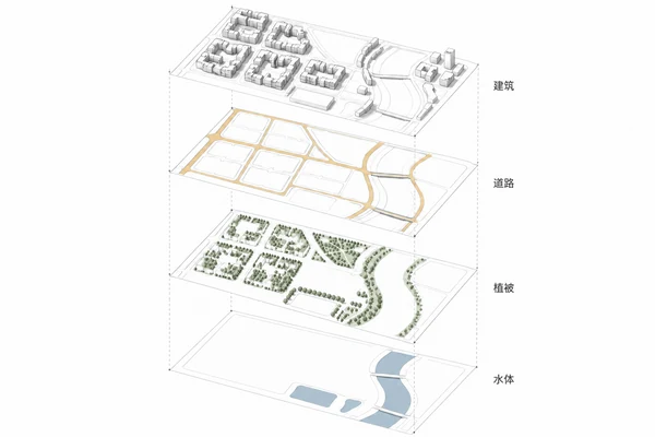
将同一城市片区拆成建筑、道路、植被、水体四层,重点保持边界、尺度和位置对齐。
Prompt
Create a landscape 3:2 urban exploded axonometric on white. Four identical rectangular layer extents centered in the image, bottom to top: water, vegetation, roads, buildings. Identical isometric orientation, scale, rotation and cropping; separate the plates vertically by equal distances and connect corresponding corners with four very pale vertical dashed guides. Do not show four unrelated maps or twisted plates. Each layer contains only its own elements and a faint site outline, not a complete repeated city. Bottom: flat grey-blue river and pond on white. Second: muted sage park and tree canopy distribution. Third: continuous light-ochre primary road ribbons and finer local branches; bridges align with river crossings below. Top: white extruded building masses with fine dark-grey edges, no trees or water. Only four short Chinese labels at the matching heights on the right: 水体, 植被, 道路, 建筑. No title or numbers. Pale contact shadows, precise aligned corners and coherent voids following the same river. With satellite or GIS input use only confirmed visible elements and preserve roads, shoreline and building positions; infer no obscured geometry, heights or risks. Otherwise invent a district with an S-shaped narrow river along the eastern side, two bridges, six western low-rise courtyard blocks, a triangular park north and rectangular pond south. No photographic satellite base plate, real place names, areas, elevations, flood zones or risk claims.