景观空间系统分层分析
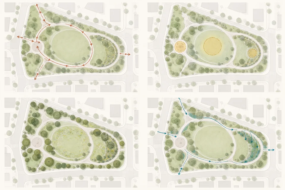
用一致底图分层表达交通、活动、植物和雨水空间的关系。 图为 AI 生成概念示例;使用时上传自己的参考图。模板免费,生成按所选线路计费。
Prompt
Use the uploaded landscape site plan as a common base for four layers: walking connections, activity nodes, planting structure and identifiable rainwater spaces. Keep identical boundaries, orientation and scale in all subdiagrams, fading the base map and using a small consistent set of accent colors. Arrows may express only connections supported by the proposal. Do not invent north direction, wind conditions, precise runoff paths or ecological metrics. Without elevations, rainwater relationships remain conceptual. Keep diagrams clear and concise, without gradients or dense arrows obscuring the site organization.